Template:POTD/2021-07-14/15
< Template:POTD | 2021-07-14
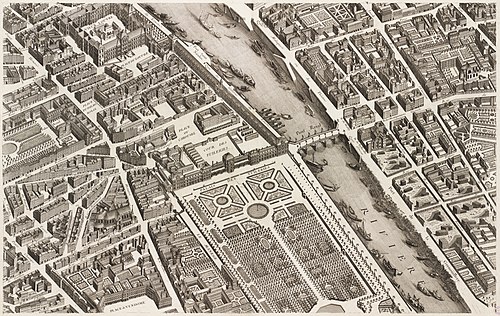
The Turgot map of Paris is a highly accurate and detailed map of the city of Paris, France, as it existed in the 1730s. It was published in 1739 as an atlas of twenty non-overlapping sectional bird's-eye-view maps, each approximately 50 cm × 80 cm (20 in × 31 in), in isometric perspective toward the southeast, as well as one simplified overview map with a four-by-five grid showing the layout of the twenty sectional maps. It has been described as "the first all-comprising graphical inventory of the capital, down to the last orchard and tree, detailing every house and naming even the most modest cul-de-sac". This is the fifteenth sheet of the Turgot map, covering the western part of the city centre, including the Louvre Palace and the Tuileries Garden on the banks of the Seine.
Other sheets: Map credit: Louis Bretez and Claude Lucas
Other sheets: Map credit: Louis Bretez and Claude Lucas

