
Portal:World
The World Portal


The world is the totality of entities, the whole of reality, or everything that exists. The nature of the world has been conceptualized differently in different fields. Some conceptions see the world as unique while others talk of a "plurality of worlds". Some treat the world as one simple object while others analyze the world as a complex made up of parts.
In scientific cosmology, the world or universe is commonly defined as "[t]he totality of all space and time; all that is, has been, and will be". Theories of modality talk of possible worlds as complete and consistent ways how things could have been. Phenomenology, starting from the horizon of co-given objects present in the periphery of every experience, defines the world as the biggest horizon or the "horizon of all horizons". In philosophy of mind, the world is contrasted with the mind as that which is represented by the mind. Theology conceptualizes the world in relation to God, for example, as God's creation, as identical to God or as the two being interdependent. In religions, there is a tendency to downgrade the material or sensory world in favor of a spiritual world to be sought through religious practice. A comprehensive representation of the world and our place in it, as is found in religions, is known as a worldview. Cosmogony is the field that studies the origin or creation of the world while eschatology refers to the science or doctrine of the last things or of the end of the world.
In various contexts, the term "world" takes a more restricted meaning associated, for example, with the Earth and all life on it, with humanity as a whole or with an international or intercontinental scope. In this sense, world history refers to the history of humanity as a whole and world politics is the discipline of political science studying issues that transcend nations and continents. Other examples include terms such as "world religion", "world language", "world government", "world war", "world population", "world economy", or "world championship". (Full article...)
Selected articles -
-

The Space Age is a period encompassing the activities related to the space race, space exploration, space technology, and the cultural developments influenced by these events, beginning with the launch of Sputnik 1 on October 4, 1957, and continuing to the present.
This period is characterized by changes in emphasis on particular areas of space exploration and applications. Initially, the United States and the Soviet Union invested unprecedented amounts of resources in breaking records and being first to meet milestones in crewed and uncrewed exploration. The United States established the National Aeronautics and Space Administration (NASA) and the USSR established the Kosmicheskaya programma SSSR to meet these goals. This period of competition gave way to cooperation between those nations and emphasis on scientific research and commercial applications of space-based technology. (Full article...) -

Early in the COVID-19 pandemic, convention centers (pictured here) were deemed to be ideal sites for temporary hospitals, due to their existing infrastructure (electrical, water, sewage). Hotels and dormitories were also considered appropriate because they can use negative pressure technology.
A pandemic (/pænˈdɛmɪk/ pan-DEM-ik) is an epidemic of an infectious disease that has spread across a large region, for instance multiple continents or worldwide, affecting a substantial number of individuals. Widespread endemic diseases with a stable number of infected individuals such as recurrences of seasonal influenza are generally excluded as they occur simultaneously in large regions of the globe rather than being spread worldwide.
Throughout human history, there have been a number of pandemics of diseases such as smallpox. The Black Death, caused by the Plague, wiped out up to half of the population of Europe in the 14th century. The term pandemic had not been used then, but was used for later epidemics, including the 1918 H1N1 influenza A pandemic—more commonly known as the Spanish flu—which is the deadliest pandemic in history. The most recent pandemics include the HIV/AIDS pandemic, the 2009 swine flu pandemic and the COVID-19 pandemic. Almost all these diseases still circulate among humans though their impact now is often far less. (Full article...) -
The Global Positioning System (GPS), originally Navstar GPS, is a satellite-based radio navigation system owned by the United States government and operated by the United States Space Force. It is one of the global navigation satellite systems (GNSS) that provide geolocation and time information to a GPS receiver anywhere on or near the Earth where there is an unobstructed line of sight to four or more GPS satellites. It does not require the user to transmit any data, and operates independently of any telephonic or Internet reception, though these technologies can enhance the usefulness of the GPS positioning information. It provides critical positioning capabilities to military, civil, and commercial users around the world. Although the United States government created, controls and maintains the GPS system, it is freely accessible to anyone with a GPS receiver. (Full article...) -
Ancient history is a time period from the beginning of writing and recorded human history through late antiquity. The span of recorded history is roughly 5,000 years, beginning with the development of Sumerian cuneiform script and continuing until the expansion of Islam in late antiquity. Ancient history covers all continents inhabited by humans in the period 3000 BC – AD 750. The three-age system periodizes ancient history into the Stone Age, the Bronze Age, and the Iron Age, with recorded history generally considered to begin with the Bronze Age. The start and end of the three ages vary between world regions. In many regions the Bronze Age is generally considered to begin a few centuries prior to 3000 BC, while the end of the Iron Age varies from the early first millennium BC in some regions to the late first millennium AD in others.
During the time period of ancient history, the world population was already exponentially increasing due to the Neolithic Revolution, which was in full progress. While in 10,000 BC, the world population stood at 2 million, it rose to 45 million by 3,000 BC. By the Iron Age in 1000 BC, the population had risen to 72 million. By the end of the ancient period in AD 500, the world population is thought to have stood at 209 million. In 10,500 years, the world population increased by 100 times. (Full article...) -
The United Nations Educational, Scientific and Cultural Organization (UNESCO) is a specialized agency of the United Nations (UN) with the aim of promoting world peace and security through international cooperation in education, arts, sciences and culture. It has 194 member states and 12 associate members, as well as partners in the non-governmental, intergovernmental and private sector. Headquartered in Paris, France, UNESCO has 53 regional field offices and 199 national commissions.
UNESCO was founded in 1945 as the successor to the League of Nations' International Committee on Intellectual Cooperation. Its constitution establishes the agency's goals, governing structure, and operating framework. UNESCO's founding mission, which was shaped by the events of World War II, is to advance peace, sustainable development and human rights by facilitating collaboration and dialogue among nations. It pursues this objective through five major programme areas: education, natural sciences, social/human sciences, culture and communication/information. UNESCO sponsors projects that improve literacy, provide technical training and education, advance science, protect independent media and press freedom, preserve regional and cultural history, and promote cultural diversity. (Full article...) -

The dodo became extinct during the mid-to-late 17th century due to habitat destruction, overhunting, and predation by introduced mammals. It is an often-cited example of a modern extinction.
The Holocene extinction, or Anthropocene extinction, is the ongoing extinction event caused by humans during the Holocene epoch. These extinctions span numerous families of plants and animals, including mammals, birds, reptiles, amphibians, fish, and invertebrates, and affecting not just terrestrial species but also large sectors of marine life. With widespread degradation of biodiversity hotspots, such as coral reefs and rainforests, as well as other areas, the vast majority of these extinctions are thought to be undocumented, as the species are undiscovered at the time of their extinction, which goes unrecorded. The current rate of extinction of species is estimated at 100 to 1,000 times higher than natural background extinction rates and is increasing. During the past 100–200 years, biodiversity loss and species extinction have accelerated, to the point that most conservation biologists now believe that human activity has either produced a period of mass extinction, or is on the cusp of doing so. As such, after the "Big Five" mass extinctions, the Holocene extinction event has also been referred to as the sixth mass extinction or sixth extinction; given the recent recognition of the Capitanian mass extinction, the term seventh mass extinction has also been proposed for the Holocene extinction event.
The Holocene extinction follows the extinction of many large (megafaunal) animals during the preceding Late Pleistocene. Some of these extinctions were likely in part due to human hunting pressure. The most popular theory is that human overhunting of species added to existing stress conditions as the Holocene extinction coincides with human colonization of many new areas around the world. Although there is debate regarding how much human predation and habitat loss affected their decline, certain population declines have been directly correlated with the onset of human activity, such as the extinction events of New Zealand, Madagascar, and Hawaii. Aside from humans, climate change may have been a driving factor in the megafaunal extinctions, especially at the end of the Pleistocene. (Full article...) -
The list of climate change controversies (or list of global warming controversies) concerns past or present public debates over certain aspects of climate change: whether it is occurring (climate change deniers dispute this), how much has occurred in modern times, what has caused it, what its effects will be, whether action should be taken to curb it now or later, and so forth. In the scientific literature, there is a very strong consensus that global surface temperatures have increased in recent decades and that the trend is caused by human-induced emissions of greenhouse gases.
The controversies are, by now, mostly political rather than scientific: there is a scientific consensus that global warming is happening and is caused by human activity. Public debates that also reflect scientific debate include estimates of how responsive the climate system might be to any given level of greenhouse gases (climate sensitivity). Disputes over the key scientific facts of global warming are more prevalent in the media than in the scientific literature, where such issues are treated as resolved, and such disputes are more prevalent in the United States and Australia than globally. (Full article...)


.jpg)
_(2).jpg)

_(14576727409).jpg)
General images -
-
 A reconstruction of human history based on fossil data. (from History of Earth)
 -
 Graph showing range of estimated partial pressure of atmospheric oxygen through geologic time (from History of Earth)
 -
 Shanghai. China urbanized rapidly in the 21st century.
 -
 Notre-Dame de Paris, France
 -

-
 The pale orange dot, an artist's impression of the early Earth which might have appeared orange through its hazy methane rich prebiotic second atmosphere. Earth's atmosphere at this stage was somewhat comparable to today's atmosphere of Titan. (from History of Earth)
 -

-

-
 Geologic map of North America, color-coded by age. From most recent to oldest, age is indicated by yellow, green, blue, and red. The reds and pinks indicate rock from the Archean.
 -
 Great Mosque of Kairouan, Tunisia, founded 670 CE
 -
 Florence, birthplace of the Italian Renaissance
 -
 A view of Earth with its global ocean and cloud cover, which dominate Earth's surface and hydrosphere; at Earth's polar regions, its hydrosphere forms larger areas of ice cover. (from Earth)
 -
 An animation of the changing density of productive vegetation on land (low in brown; heavy in dark green) and phytoplankton at the ocean surface (low in purple; high in yellow) (from Earth)
 -
 Ajloun Castle, Jordan
 -
 Artist's conception of Hadean Eon Earth, when it was much hotter and inhospitable to all forms of life. (from History of Earth)
 -
 An artist's impression of ice age Earth at glacial maximum. (from History of Earth)
 -
 Empires of the world in 1898
 -
 Cross-section through a liposome (from History of Earth)
 -
 An artist's impression of the Archean, the eon after Earth's formation, featuring round stromatolites, which are early oxygen-producing forms of life from billions of years ago. After the Late Heavy Bombardment, Earth's crust had cooled, its water-rich barren surface is marked by continents and volcanoes, with the Moon still orbiting Earth half as far as it is today, appearing 2.8 times larger and producing strong tides. (from Earth)
 -

-
 Yggdrasil, an attempt to reconstruct the Norse world tree which connects the heavens, the world, and the underworld. (from World)
 -
 Machu Picchu, Inca Empire, Peru
 -
 A reconstruction of Pannotia (550 Ma). (from History of Earth)
 -
 A 580 million year old fossil of Spriggina floundensi, an animal from the Ediacaran period. Such life forms could have been ancestors to the many new forms that originated in the Cambrian Explosion. (from History of Earth)
 -
 Change in average surface air temperature and drivers for that change. Human activity has caused increased temperatures, with natural forces adding some variability. (from Earth)
 -

-
 Lithified stromatolites on the shores of Lake Thetis, Western Australia. Archean stromatolites are the first direct fossil traces of life on Earth. (from History of Earth)
 -

-

-

-
 Map of peopling of the world (Southern Dispersal paradigm), in thousands of years ago.
 -

-
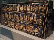
 A Benin Bronze head from Nigeria
 -
 First airplane, the Wright Flyer, flew on 17 December 1903.
 -
 Satellite time lapse imagery of Earth's rotation showing axis tilt (from Earth)
 -
 Tiktaalik, a fish with limb-like fins and a predecessor of tetrapods. Reconstruction from fossils about 375 million years old. (from History of Earth)
 -
 A map of heat flow from Earth's interior to the surface of Earth's crust, mostly along the oceanic ridges (from Earth)
 -
 A composite image of Earth, with its different types of surface discernible: Earth's surface dominating Ocean (blue), Africa with lush (green) to dry (brown) land and Earth's polar ice in the form of Antarctic sea ice (grey) covering the Antarctic or Southern Ocean and the Antarctic ice sheet (white) covering Antarctica. (from Earth)
 -
 View of Earth from the Moon by the Lunar Reconnaissance Orbiter (from Earth)
 -
 Taj Mahal, Mughal Empire, India
 -
 Obelisk of Axum, Ethiopia
 -
Pale orange dot, an artist's impression of Early Earth, featuring its tinted orange methane-rich early atmosphere (from Earth)
-

-
 Earth's land use for human agriculture in 2019 (from Earth)
 -

-
 Chloroplasts in the cells of a moss (from History of Earth)
 -
 A composite image of artificial light emissions at night on a map of Earth (from Earth)
 -
 Dinosaurs were the dominant terrestrial vertebrates throughout most of the Mesozoic (from History of Earth)
 -
 Chennakesava Temple, Belur, India
 -
 Japanese depiction of a Portuguese carrack. European maritime innovations led to proto-globalization.
 -
 Battle during 1281 Mongol invasion of Japan
 -
 Pangaea was a supercontinent that existed from about 300 to 180 Ma. The outlines of the modern continents and other landmasses are indicated on this map. (from History of Earth)
 -
 Fall of the Berlin Wall, 1989
 -
 An artist's rendering of a protoplanetary disk (from History of Earth)
 -
 Standing Buddha from Gandhara, 2nd century CE
 -
 Persepolis, Achaemenid Empire, 6th century BCE
 -

-

-
 Angkor Wat temple complex, Cambodia, early 12th century
 -
 The Pantheon, originally a Roman temple, now a Catholic church
 -
 A pillar at Göbekli Tepe
 -
 "Lucy", the first Australopithecus afarensis skeleton found. Lucy was only 1.06 m (3 ft 6 in) tall.
 -

-
 Earth's western hemisphere showing topography relative to Earth's center instead of to mean sea level, as in common topographic maps (from Earth)
 -
 Earth's night-side upper atmosphere appearing from the bottom as bands of afterglow illuminating the troposphere in orange with silhouettes of clouds, and the stratosphere in white and blue. Next the mesosphere (pink area) extends to the orange and faintly green line of the lowest airglow, at about one hundred kilometers at the edge of space and the lower edge of the thermosphere (invisible). Continuing with green and red bands of aurorae stretching over several hundred kilometers. (from Earth)
 -
Artist's impression of Earth during the later Archean, the largely cooled planetary crust and water-rich barren surface, marked by volcanoes and continents, features already round microbialites. The Moon, still orbiting Earth much closer than today and still dominating Earth's sky, produced strong tides. (from History of Earth)
-
 Image of the physical world, captured by the Hubble Space Telescope (from World)
 -

-
 Ming dynasty section, Great Wall of China
 -
 Great Pyramids of Giza, Egypt
 -
 Tracy Caldwell Dyson, a NASA astronaut, observing Earth from the Cupola module at the International Space Station on 11 September 2010 (from Earth)
 -
 A banded iron formation from the 3.15 Ga Moodies Group, Barberton Greenstone Belt, South Africa. Red layers represent the times when oxygen was available; gray layers were formed in anoxic circumstances. (from History of Earth)
 -
 Vitruvian Man by Leonardo da Vinci epitomizes the advances in art and science seen during the Renaissance. (from History of Earth)
 -
 Earth's axial tilt causing different angles of seasonal illumination at different orbital positions around the Sun (from Earth)
 -
 A 2012 artistic impression of the early Solar System's protoplanetary disk from which Earth and other Solar System bodies were formed (from Earth)
 -
 Artist's rendition of an oxinated fully-frozen Snowball Earth with no remaining liquid surface water. (from History of Earth)
 -
 Trilobites first appeared during the Cambrian period and were among the most widespread and diverse groups of Paleozoic organisms. (from History of Earth)
 -
 Artist's impression of a Hadean landscape with the relatively newly formed Moon still looming closely over Earth and both bodies sustaining strong volcanism. (from History of Earth)
 -

-
 A computer-generated image mapping the prevalence of artificial satellites and space debris around Earth in geosynchronous and low Earth orbit (from Earth)
 -
 A view of Earth with different layers of its atmosphere visible: the troposphere with its clouds casting shadows, a band of stratospheric blue sky at the horizon, and a line of green airglow of the lower thermosphere around an altitude of 100 km, at the edge of space (from Earth)
 -

-

-
 The replicator in virtually all known life is deoxyribonucleic acid. DNA is far more complex than the original replicator and its replication systems are highly elaborate. (from History of Earth)
 -
 Last Moon landing: Apollo 17 (1972)
 -

-
 A schematic view of Earth's magnetosphere with solar wind flowing from left to right (from Earth)
 -
 Olmec colossal head, now at the Museo de Antropología de Xalapa
 -
 Earth's history with time-spans of the eons to scale (from History of Earth)
 -
 Artist's conception of Devonian flora (from History of Earth)
 -

-
 Artist's impression of the enormous collision that probably formed the Moon (from History of Earth)


.jpg)


.jpg)


.jpeg)


.svg)


.jpg)


Megacities of the world -
.jpg)
Hangzhou is the capital and most populous city of Zhejiang, China. It is located in the northeastern part of the province, sitting at the head of Hangzhou Bay, which separates Shanghai and Ningbo. Hangzhou grew to prominence as the southern terminus of the Grand Canal and has been one of China's most renowned and prosperous cities for much of the last millennium. It is a major economic and e-commerce hub within China, and the second biggest city in the Yangtze Delta after Shanghai. Hangzhou is classified as a sub-provincial city and forms the core of the Hangzhou metropolitan area, the fourth-largest in China after Guangzhou-Shenzhen Pearl River agglomeration, Shanghai-Suzhou-Wuxi-Changzhou conurbation and Beijing. As of 2022, the Hangzhou metropolitan area was estimated to produce a gross metropolitan product (nominal) of 4 trillion yuan (US$590 billion), making it larger than the economy of Sweden. As of the 2020 Chinese census, it had a total population of 11,936,010 inhabitants. However, its metropolitan area, populated by 13.035 million people over an area of 8,107.9 km2 (3,130.5 sq mi), consists of all urban districts in Hangzhou and 3 urban districts of the city of Shaoxing.
Hangzhou has been repeatedly rated as the best commercial city in mainland China by Forbes and the Chinese city with the highest growth potential by the Economist Intelligence Unit. A study conducted by PwC and China Development Research Foundation ranked Hangzhou first among "Chinese Cities of Opportunity". According to the Globalization and World Cities Research Network (GaWC), the city is classified as a Beta (global second-tier) city, together with Chongqing, Nanjing and Tianjin in China. Hangzhou is also one of the world's top 100 financial centers, according to the Global Financial Centres Index. It boasts the eighth largest GDP among cities in mainland China with a GDP of around 1.8 trillion RMB ($280 billion). Home to the headquarters of large global tech companies such as Alibaba Group, Ant Group, and NetEase, Hangzhou is known for attracting professionals and entrepreneurs who work in information technology. , Hangzhou has the tenth-most Fortune Global 500 headquarters of any city in the world and the fourth-most in China – after Beijing, Shanghai and Shenzhen – within its city limits. According to the 2020 Hurun Global Rich List, Hangzhou ranks 11th in the world and 6th in China (after Beijing, Shanghai, Hong Kong, Shenzhen and Guangzhou) in the number of resident billionaires. (Full article...)Did you know -

- ... the Tala tank is the largest overhead water reservoir in the world?
- ... that actress Klara Höfels, known for her roles in television crime series, also produced, directed, and starred in world premieres of theatre projects in Berlin?
- ... that Meteor Studios created "realistic CG on TV budgets", but went bankrupt after completing visual effects work for Journey to the Center of the Earth?
- ... that after being hijacked, United Airlines Flight 175 almost had two mid-air collisions with other aircraft before crashing into the South Tower of the World Trade Center?
- ... that the Brazilian cruiser Almirante Barroso was on a voyage to circumnavigate Earth with Prince August Leopold on board when the republic was proclaimed in Brazil?
- ... that Judith Ehrlich incorporated her NPR work on pacifism into a documentary focusing on conscientious objectors during World War II?
- ... that Larry Herndon hit a game-winning home run in the 1984 World Series and a playoff-clinching home run on the last day of the 1987 season?
- ... that photographing Elliot Page for the cover of Time "really meant the world" to Canadian photographer Wynne Neilly?
Countries of the world -

Romania is a country located at the crossroads of Central, Eastern and Southeastern Europe. It borders Ukraine to the north and east, Hungary to the west, Serbia to the southwest, Bulgaria to the south, Moldova to the east, and the Black Sea to the southeast. It has a predominantly continental climate, and an area of 238,397 km2 (92,046 sq mi) with a population of 19 million people (2023). Romania is the twelfth-largest country in Europe and the sixth-most populous member state of the European Union. Its capital and largest city is Bucharest, followed by Cluj-Napoca, Iași, Timișoara, Constanța, Craiova, Brașov, and Galați.
Europe's second-longest river, the Danube, rises in Germany's Black Forest and flows southeast for 2,857 km (1,775 mi), before emptying into Romania's Danube Delta. The Carpathian Mountains cross Romania from the north to the southwest and include Moldoveanu Peak, at an altitude of 2,544 m (8,346 ft). (Full article...)Related portals
Protected areas of the world -
-
This is a list of protected areas of Romania.
About 5.18% of the area of Romania has a protected status (12,360 km2), including the Danube Delta, which makes half of these areas (2.43% of Romania's area). (Full article...) -

Overview of IUCN Protected area - WAP (W, Arli, Pendjari) area - Niger, Burkina Faso, and Benin
The following is a list of protected areas of Burkina Faso. (Full article...) -
This is a list of protected areas of Saudi Arabia, some of which are managed by the Saudi Wildlife Authority.:
- At-Taysiyah Protected Area
- Jabal Shada Nature Reserve
- Majami'al-Hadb Protected Area
- Nafud al-'Urayq
- Raydah Natural Reserve
- 'Uruq Bani Ma'arid
- Saja Umm Ar-Rimth Natural Reserve
- Harrat al-Harrah Protected Area
- Al-Khunfah Natural Reserve
- Ibex Reserve Protected Area
- Mahazat as-Sayd Protected Area
- Umm al-Qamari Islands
- Al-Tubayq Natural Reserve
- Farasan Islands Protected Area
- Jubail Marine Wildlife Sanctuary
- Jabal Aja Protected Area
- Wadi Turabah Nature Reserve
-
This list of protected areas of Manitoba groups the protected areas of Manitoba by the agency that is responsible for their protection. (Full article...)
-
The protected areas of Michigan come in an array of different types and levels of protection. Michigan has five units of the National Park Service system. There are 14 federal wilderness areas; the majority of these are also tribal-designated wildernesses. It has one of the largest state forest systems as well having four national forests. The state maintains a large state park system and there are also regional parks, and county, township and city parks. Still other parks on land and in the Great Lakes are maintained by other governmental bodies. Private protected areas also exist in the state, mainly lands owned by land conservancies. (Full article...)
-
Illinois has a variety of protected areas, including over 123 state-protected areas, dozens of federally protected areas, hundreds of county-level and municipal park areas. Illinois also contains sites designated as internationally important protected areas. These multiple levels of protection contribute to a statewide network of numerous recreation opportunities and conservation schemes, sometimes in a small area. For example, DeKalb County contains a 1,000-acre (4.0 km2) forest preserve system and a 1,500-acre (6.1 km2) state park (Shabbona Lake State Park); within DeKalb County, the DeKalb Park District in the City of DeKalb has a 700-acre (2.8 km2) park system. (Full article...)
-
Protected areas of Libya include any geographical area protected for a specific use.
Most protected areas are intended for the conservation of flora and fauna. Libya's national parks and nature reserves are maintained by the "Technical Committee of Wildlife and National Parks" which was created in 1990, as part of the General Secretariat of Agricultural Reclamation and Land Reform. (Full article...) -
Cadw is the historic environment service of the Welsh Government which manages historical buildings and ancient monuments in Wales. (Full article...)
-

The sun over the Lake Niassa Reserve
Protected areas in Mozambique are known as conservation areas, and are currently grouped into national parks, national reserves, forest reserves, wildlife utilisation areas (coutadas), community conservation areas, and private game farms (fazendas de bravio). There are also a number of areas that have been declared as protected areas under a variety of different legislation, which for reasons of simplicity are here grouped together as "other protected areas." Under the Conservation Law of 2014 (Law 16/2014 of June 20), protected areas will need to be reclassified into a much more flexible series of new categories which are closer to the international system used by the IUCN. International initiatives such as transfrontier parks are grouped at the end of the page. (Full article...) -
Protected areas of the European Union are areas which need and/or receive special protection because of their environmental, cultural or historical value to the member states of the European Union.
(Full article...) -
Protected areas of Australia include Commonwealth and off-shore protected areas managed by the Australian government, as well as protected areas within each of the six states of Australia and two self-governing territories, the Australian Capital Territory and the Northern Territory, which are managed by the eight state and territory governments.
Commonwealth and off-shore protected areas in the Australian Capital Territory, the Northern Territory, the Christmas Island Territory, the Cocos (Keeling) Islands Territory, the Norfolk Island Territory and the Australian Antarctic Territory are managed by Director of National Parks, an agency within the Department of the Environment and Energy, with the exception of the Great Barrier Reef Marine Park, which is managed by the Great Barrier Reef Marine Park Authority, a separate body within the department. (Full article...) -
Forests in the state of Himachal Pradesh (northern India) currently cover an area of nearly 37,939 square kilometres (14,648 sq mi), which is about 68.16% of the total land area of the state. The forests were once considered to be the main source of income of the state and most of the original forests were clear felled. The emphasis has shifted, however, from exploitation to conservation. The state government aims to increase forest cover to 50% of the total land area. There have been various projects, including the establishment of protected areas such as National Parks, designed to preserve and expand the forests. (Full article...)
-

Cranes at Sevan National Park
This is a list of protected areas in Armenia that are categorized as follows: 4 national parks, 3 state reserves, 27 state sanctuaries and 5 botanical gardens. (Full article...) -
Protected areas in the U.S. State of Ohio include national forest lands, Army Corps of Engineers areas, state parks, state forests, state nature preserves, state wildlife management areas, and other areas. (Full article...)
-
Protected areas of Ukraine (Ukrainian: охоронні території) are special areas of Ukraine established with the goal of protecting the natural and cultural heritage of the country from excessive changes as a result of human activity. The protection of the areas is the responsibility of the government of Ukraine, specifically the Cabinet of Ministers of Ukraine.
Ukraine has several categories of protected areas of Ukraine and the protected areas include: (Full article...)

.jpg)

Selected world maps
-
 Mollweide projection of the world
 -
 The world map by Gerardus Mercator (1569), the first map in the well-known Mercator projection
 -
 Only a few of the largest large igneous provinces appear (coloured dark purple) on this geological map, which depicts crustal geologic provinces as seen in seismic refraction data
 -
 United Nations Human Development Index map by country (2016)
 -
 Index map from the International Map of the World (1:1,000,000 scale)
 -
 A plate tectonics map with volcano locations indicated with red circles
 -
 The Goode homolosine projection is a pseudocylindrical, equal-area, composite map projection used for world maps.
 -
 1516 map of the world by Martin Waldseemüller
 -
 Time zones of the world


World records
- List of Olympic records in athletics
- List of world records in athletics
- List of junior world records in athletics
- List of world records in masters athletics
- List of world youth bests in athletics
- List of IPC world records in athletics
- List of world records in canoeing
- List of world records in chess
- List of cycling records
- List of world records in track cycling
- List of world records in finswimming
- List of world records in juggling
- List of world records in rowing
- List of world records in speed skating
- List of world records in swimming
- List of IPC world records in swimming
- List of world records in Olympic weightlifting
Topics

Continents of Earth | ||||||||
|---|---|---|---|---|---|---|---|---|
| ||||||||
| ||||||||
| ||||||||


| Cenozoic Era (present–66.0 Ma) |
| ||||||||||||
|---|---|---|---|---|---|---|---|---|---|---|---|---|---|
| Mesozoic Era (66.0–252 Ma) |
| ||||||||||||
| Paleozoic Era (252–539 Ma) |
| ||||||||||||
| Proterozoic Eon (539 Ma–2.5 Ga) |
| ||||||||||||
| Archean Eon (2.5–4 Ga) | |||||||||||||
| Hadean Eon (4–4.6 Ga) | |||||||||||||
ka = kiloannum (thousands years ago); Ma = megaannum (millions years ago); Ga = gigaannum (billions years ago). See also: Geologic time scale • | |||||||||||||
| Locations | ||
|---|---|---|
| Related | ||

| |||||||||||||||||||
| |||||||||||||||||||
| |||||||||||||||||||

Economic classification of countries | |||||
|---|---|---|---|---|---|
| Three-World Model | |||||
| Gross domestic product (GDP) |
| ||||
| Gross national income (GNI) | |||||
| Wages | |||||
| Wealth | |||||
| Other national accounts | |||||
| Human development | |||||
| Digital divide | |||||
| Net international investment position (NIIP) | |||||
| Technological |
| ||||
|---|---|---|---|---|---|
| Sociological | |||||
| Ecological |
| ||||
| Biological |
| ||||
| Astronomical | |||||
| Eschatological |
| ||||
| Others |
| ||||
| Fictional | |||||
| Organizations | |||||
Categories

Wikimedia
The following Wikimedia Foundation sister projects provide more on this subject:
-
 Commons
Free media repository -
 Wikibooks
Free textbooks and manuals -
 Wikidata
Free knowledge base -
 Wikinews
Free-content news -
 Wikiquote
Collection of quotations -
 Wikisource
Free-content library -
 Wikispecies
Directory of species -
 Wikiversity
Free learning tools -
 Wikivoyage
Free travel guide -
 Wiktionary
Dictionary and thesaurus


