
Kadan Kyun

Kadan Kyun
Location of Kadan Kyun in Myanmar
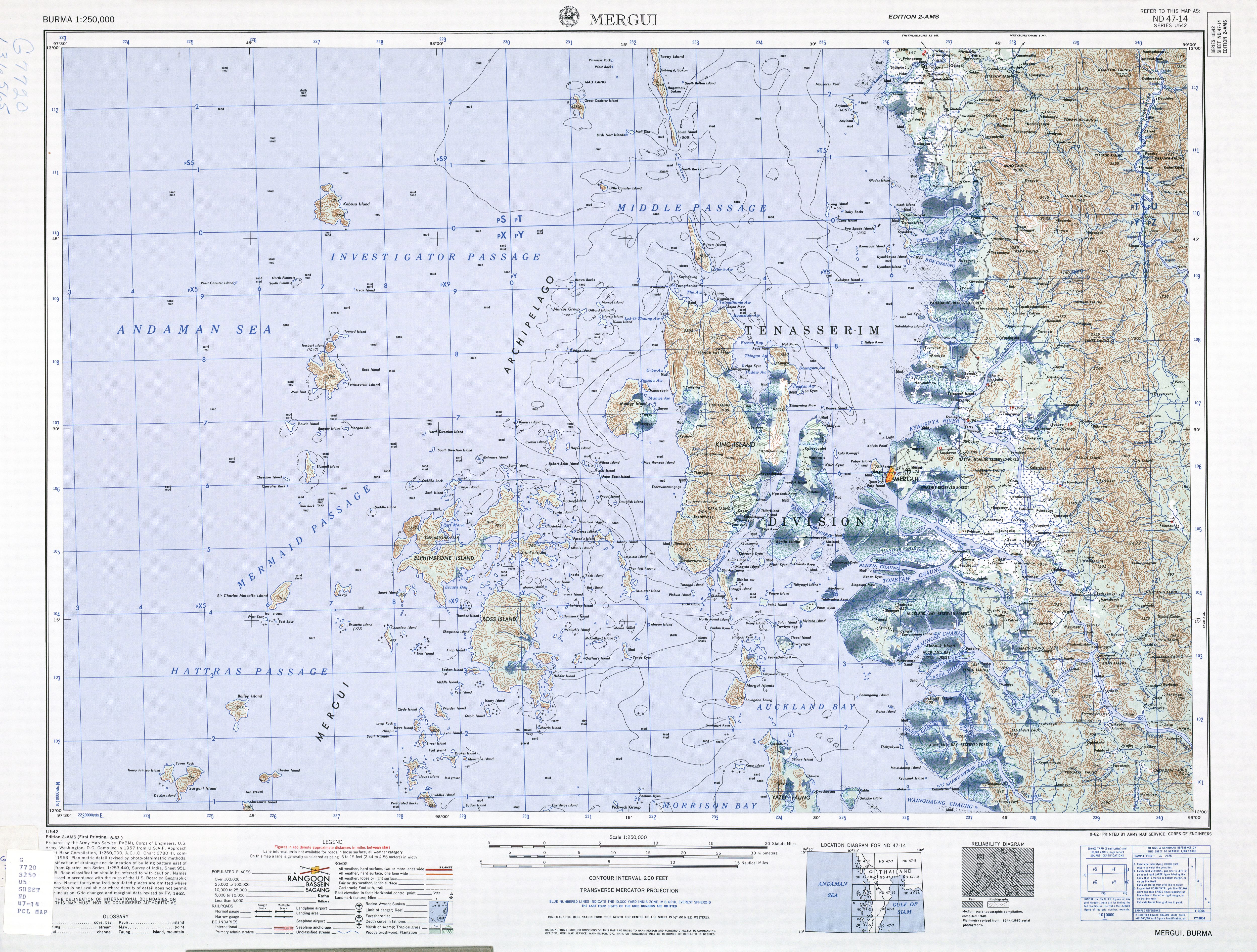
Kadan Kyun is the largest island in the Mergui Archipelago, Myanmar. Its area is 450 square kilometres (170 sq mi). The highest point is French Bay Peak (767 m (2,516 ft)),[1] which is the highest point in the archipelago.[2]
Etymology[edit]
Under the British, the island was known as King Island,[1][3] King's Island,[4] and later as Kadan Island or Kadan Kyun, based on the local pronunciation.[5]
Communities[edit]
Among the communities on Kadan Island are Gyindaungchaung,[6] Kabingyaung,[7] Kapa,[8] Kyataw,[9] Mayanchaung,[10] Tharawuntaungnge[11] and Yemyitkyi.[12]
See also[edit]
Notes[edit]
- ^ a b "Burma 1:250,000 topographic map, Series U542, Mergui, ND 47-14" U.S. Army Map Service, August 1962
- ^ Bird, Eric C. F. (2010). Encyclopedia of the World's Coastal Landforms. Netherlands: Springer Verlag. p. 1085. ISBN 978-1-4020-8638-0 – via Google Books.
- ^ "King Island (Approved)" Kadan Kyun at GEOnet Names Server, United States National Geospatial-Intelligence Agency
- ^ "King's Island (Variant)" Kadan Kyun at GEOnet Names Server, United States National Geospatial-Intelligence Agency
- ^ Klinkmüller, Volker et al. (2003) "Kadan Kyun (Kyunsu)" Myanmar DuMont-Reiseverlag, Ostfildern, Germany, page 471 ISBN 3-7701-6147-5, in German
- ^ "Gyindaungchaung Map — Satellite Images of Gyindaungchaung" Maplandia World Gazetteer
- ^ "Kabingyaung Map — Satellite Images of Kabingyaung" Maplandia World Gazetteer
- ^ "Kapa Map — Satellite Images of Kapa" Maplandia World Gazetteer
- ^ "Kyat-aw (Approved)" Kadan Kyun at GEOnet Names Server, United States National Geospatial-Intelligence Agency
- ^ "Mayanchaung Map — Satellite Images of Mayanchaung" Maplandia World Gazetteer
- ^ "Tharawuntaungnge Map — Satellite Images of Tharawuntaungnge" Maplandia World Gazetteer
- ^ "Yemyitkyi Map — Satellite Images of Yemyitkyi" Maplandia World Gazetteer
12°30′N 98°22′E / 12.500°N 98.367°E
This Myanmar location article is a stub. You can help Wikipedia by expanding it. |