
File:2019 Safir rocket explosion U.S. overhead imagery - NGA declass.pdf
Size of this JPG preview of this PDF file: 776 × 600 pixels. Other resolutions: 311 × 240 pixels | 621 × 480 pixels | 994 × 768 pixels | 1,280 × 989 pixels | 1,650 × 1,275 pixels.
Original file (1,650 × 1,275 pixels, file size: 209 KB, MIME type: application/pdf)
| This is a file from the Wikimedia Commons. Information from its description page there is shown below. Commons is a freely licensed media file repository. You can help. |
Summary
| Description |
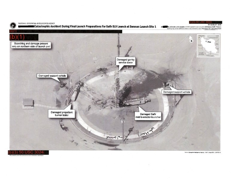
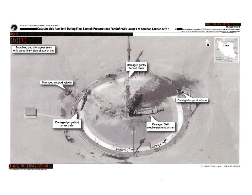
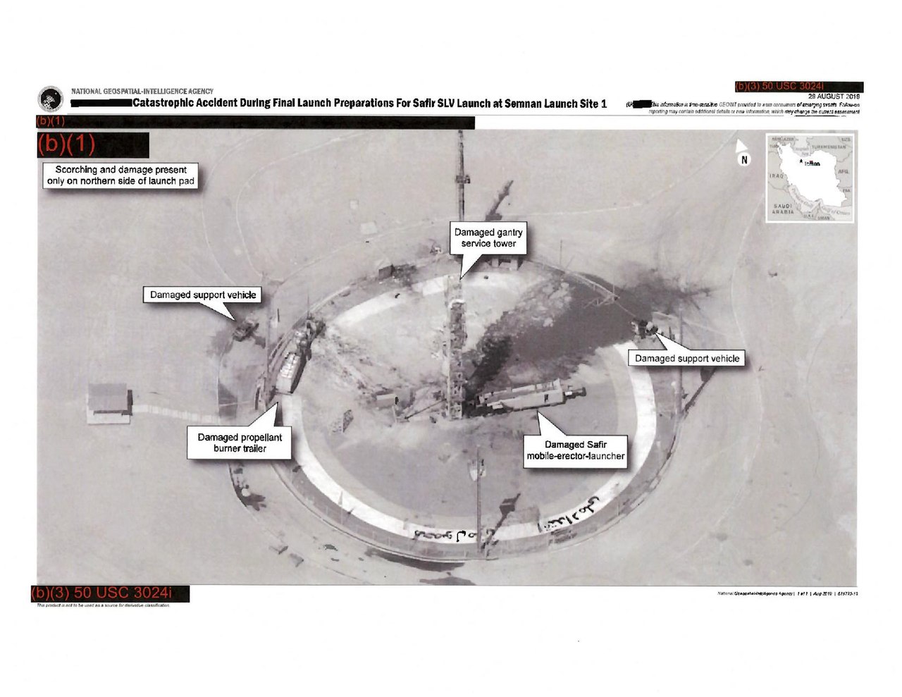
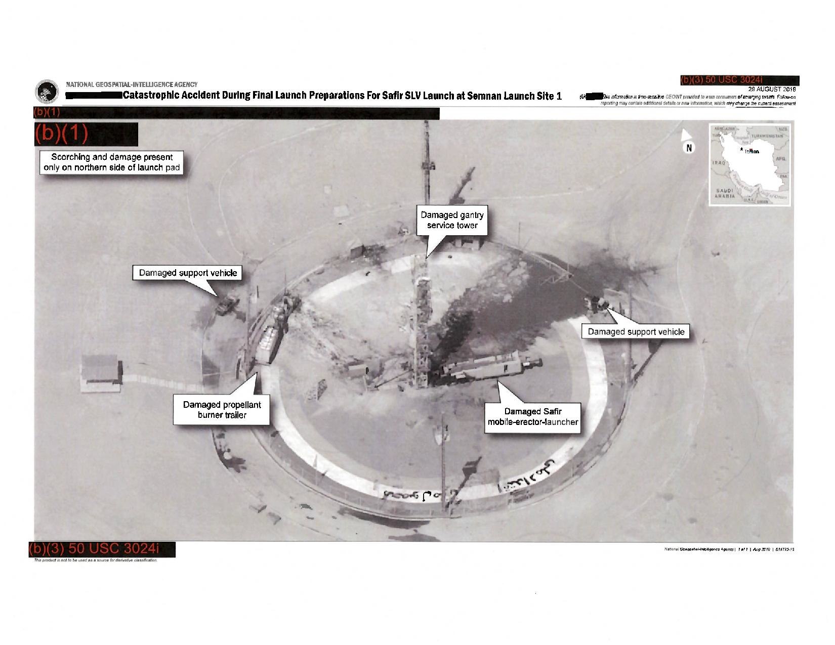
English: A redacted declassified version of the satellite imagery of Iranian rocket test wreckage included in a tweet by President Donald Trump in 2019, which was released by the U.S. National Geospatial Intelligence Agency in 2022. |
|||
| Date | ||||
| Source | https://www.npr.org/2022/11/18/1137474748/trump-tweeted-an-image-from-a-spy-satellite-declassified-document-shows | |||
| Author | National Geospatial Intelligence Agency | |||
| Permission (Reusing this file) |
|

File history
Click on a date/time to view the file as it appeared at that time.
| Date/Time | Thumbnail | Dimensions | User | Comment | |
|---|---|---|---|---|---|
| current | 14:44, 18 November 2022 |  | 1,650 × 1,275 (209 KB) | Abovfold | Uploaded a work by National Geospatial Intelligence Agency from https://www.npr.org/2022/11/18/1137474748/trump-tweeted-an-image-from-a-spy-satellite-declassified-document-shows with UploadWizard |
File usage
The following pages on the English Wikipedia use this file (pages on other projects are not listed):