
File:UAE divisions.jpg
No higher resolution available.
UAE_divisions.jpg (617 × 496 pixels, file size: 96 KB, MIME type: image/jpeg)
| This is a file from the Wikimedia Commons. Information from its description page there is shown below. Commons is a freely licensed media file repository. You can help. |
Summary

|
This locator map image could be re-created using vector graphics as an SVG file. This has several advantages; see Commons:Media for cleanup for more information. If an SVG form of this image is available, please upload it and afterwards replace this template with
{{vector version available|new image name}}.
It is recommended to name the SVG file “UAE divisions.svg”—then the template Vector version available (or Vva) does not need the new image name parameter. |


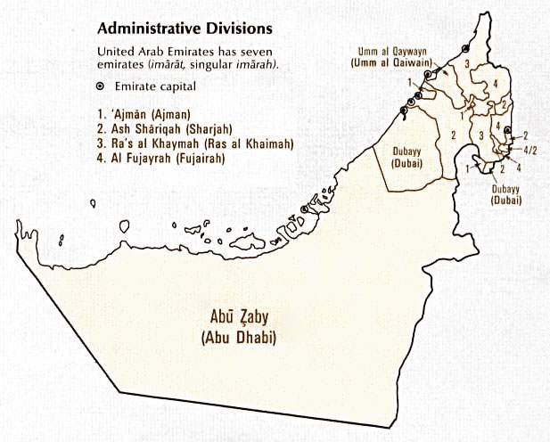
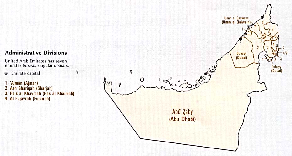
| Description | A map showing the seven Emirates of the United Arab Emirates. |
| Date | published January 1993 |
| Source |
Digital file: http://www.lib.utexas.edu/maps/atlas_middle_east/uae_division.jpg |
| Author | U.S. Central Intelligence Agency |
| Permission (Reusing this file) |
Public domain |
Licensing
| This image is a work of a Central Intelligence Agency employee, taken or made as part of that person's official duties. As a Work of the United States Government, this image or media is in the public domain in the United States.
|

|
File history
Click on a date/time to view the file as it appeared at that time.
| Date/Time | Thumbnail | Dimensions | User | Comment | |
|---|---|---|---|---|---|
| current | 12:38, 27 October 2006 | | 617 × 496 (96 KB) | Conscious | newest version from en: |
| 10:53, 6 September 2005 |  | 930 × 496 (61 KB) | Thryduulf | A map showing the seven Emirates of the United Arab Emirates. Source is [http://www.lib.utexas.edu/maps/atlas_middle_east/uae_division.jpg] which states that "These maps and charts are scanned from ''Atlas of the Middle East'', published in January 1 |
File usage
The following pages on the English Wikipedia use this file (pages on other projects are not listed):
Global file usage
The following other wikis use this file:
- Usage on azb.wikipedia.org
- Usage on de.wikipedia.org
- Usage on nl.wikipedia.org
- Usage on sq.wikipedia.org