
File:Sacajawea Patera PIA00485.jpg
Size of this preview: 750 × 600 pixels. Other resolutions: 300 × 240 pixels | 600 × 480 pixels | 960 × 768 pixels | 1,280 × 1,024 pixels | 1,880 × 1,504 pixels.
Original file (1,880 × 1,504 pixels, file size: 696 KB, MIME type: image/jpeg)
| This is a file from the Wikimedia Commons. Information from its description page there is shown below. Commons is a freely licensed media file repository. You can help. |
Summary
| Description |
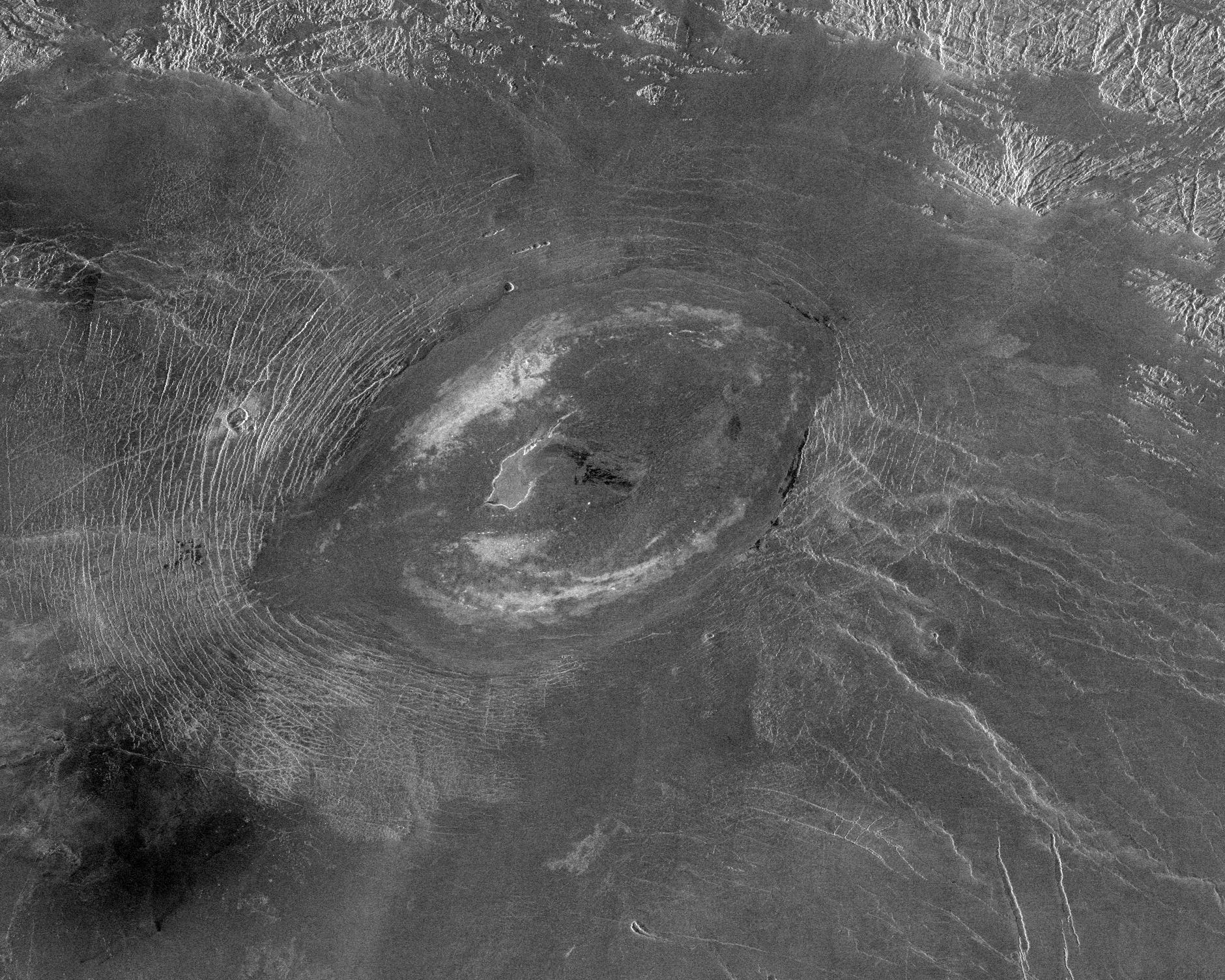
English: This Magellan image reveals Sacajawea Patera, a large, elongate caldera located in Western Ishtar Terra on the smooth plateau of Lakshmi Planum. The image is centered at 64.5 degrees North latitude and 337 degrees East longitude. It is approximately 420 kilometers (252 miles) wide at the base. Sacajawea is a depression approximately 1-2 kilometers (0.6-1.2 miles) deep and 120 x 215 kilometers (74 x 133 miles) in diameter; it is elongate in a southwest-northeast direction. The depression is bounded by a zone of circumferential curvilinear structures interpreted to be graben and fault scarps. These structures are spaced 0.5-4 kilometers (0.3-2.5 miles) apart, are 0.6-4.0 kilometers (0.4-2.5 miles) in width and up to 100 kilometers (62 miles) in length. Extending up to approximately 140 kilometers (87 miles) in length from the southeast of the patera is a system of linear structures thought to represent a flanking rift zone along which the lateral injection and eruption of magma may have occurred. A shield edifice 12 kilometers (7 miles) in diameter with a prominent central pit lies along the trend of one of these features. The impact crater Zlata, approximately 6 kilometers (4 miles) in diameter is located within the zone of graben to the northwest of the patera. Few flow features are observed in association with Sacajawea, possibly due to age and state of degradation of the flows. Mottled bright deposits 4-20 kilometers (2.5-12 miles) in width are located near the periphery and in the center of the patera floor within local topographic lows. Diffuse patches of dark material approximately 40 kilometers (25 miles) in width are observed southwest of the patera, superposed on portions of the surrounding graben. The formation of Sacajawea is thought to be related to the drainage and collapse of a large magma chamber. Gravitational relaxation may have caused the resultant caldera to sag, producing the numerous faults and graben that circumscribe the patera. Regions of complex, highly deformed tessera-like terrain are located north and east of the patera and are seen in the upper portion of the image. |
| Source | http://photojournal.jpl.nasa.gov/catalog/PIA00485 |
| Author | Magellan probe |
Licensing
| This file is in the public domain in the United States because it was solely created by NASA. NASA copyright policy states that "NASA material is not protected by copyright unless noted". (See Template:PD-USGov, NASA copyright policy page or JPL Image Use Policy.) | ||
 |
Warnings:
|
File history
Click on a date/time to view the file as it appeared at that time.
| Date/Time | Thumbnail | Dimensions | User | Comment | |
|---|---|---|---|---|---|
| current | 22:02, 6 April 2008 | | 1,880 × 1,504 (696 KB) | Bryan Derksen | {{Information |Description={{en|This Magellan image reveals Sacajawea Patera, a large, elongate caldera located in Western Ishtar Terra on the smooth plateau of Lakshmi Planum. The image is centered at 64.5 degrees North latitude and 337 degrees East long |
File usage
The following pages on the English Wikipedia use this file (pages on other projects are not listed):
Global file usage
The following other wikis use this file:
- Usage on fr.wikipedia.org
- Usage on gl.wikipedia.org
- Usage on nl.wikipedia.org
- Usage on oc.wikipedia.org
- Usage on sr.wikipedia.org
- Usage on zh.wikipedia.org