
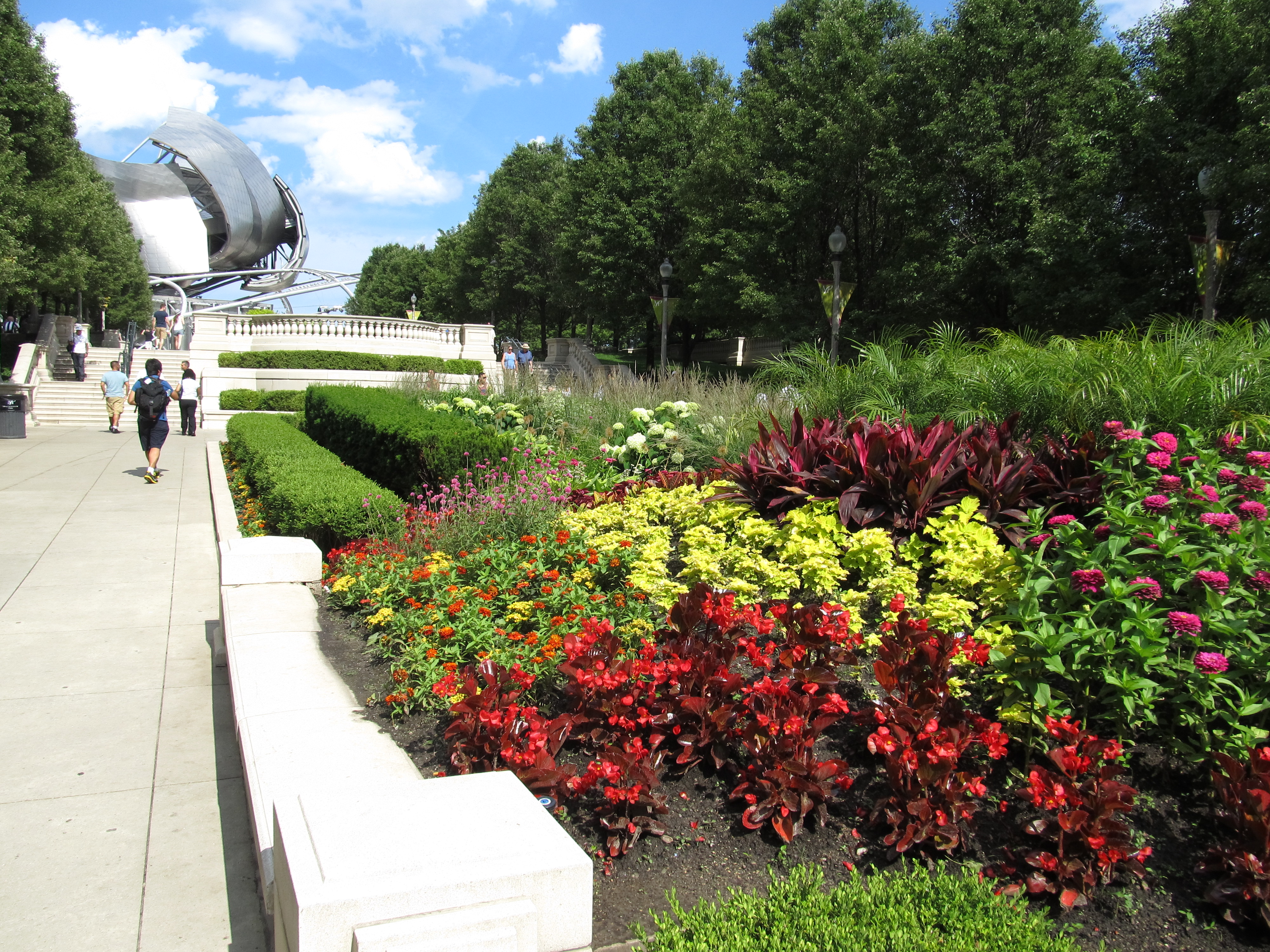
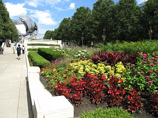
File:Millennium Square, Chicago, Illinois (9181701264).jpg
Original file (4,000 × 3,000 pixels, file size: 4.16 MB, MIME type: image/jpeg)
| This is a file from the Wikimedia Commons. Information from its description page there is shown below. Commons is a freely licensed media file repository. You can help. |
.jpg)
Summary
| Description |
Millennium Park is a public park located in the Loop community area of Chicago in Illinois, USA and originally intended to celebrate the millennium. It is a prominent civic center near the city's Lake Michigan shoreline that covers a 24.5-acre (99,000 m2) section of northwestern Grant Park. The area was previously occupied by parkland, Illinois Central rail yards, and parking lots. The park, which is bounded by Michigan Avenue, Randolph Street, Columbus Drive and East Monroe Drive, features a variety of public art. As of 2009, Millennium Park trailed only Navy Pier as a Chicago tourist attraction. Planning of the park began in October 1997. Construction began in October 1998, and Millennium Park was opened in a ceremony on July 16, 2004, four years behind schedule. The three-day opening celebrations were attended by some 300,000 people and included an inaugural concert by the Grant Park Orchestra and Chorus. The park has received awards for its accessibility and green design. Millennium Park has free admission, and features the Jay Pritzker Pavilion, Cloud Gate, the Crown Fountain, the Lurie Garden, and various other attractions. The park is connected by the BP Pedestrian Bridge and the Nichols Bridgeway to other parts of Grant Park. Because the park sits atop a parking garage and the commuter rail Millennium Station, it is considered the world's largest rooftop garden. en.wikipedia.org/wiki/Millennium_Park en.wikipedia.org/wiki/Wikipedia:Text_of_Creative_Commons_... |
| Date | |
| Source | Millennium Square, Chicago, Illinois |
| Author | Ken Lund from Reno, Nevada, USA |
| Camera location | | View this and other nearby images on: OpenStreetMap |
|---|
.jpg¶ms=041.883293_N_-087.623423_E_globe:Earth_type:camera_source:Flickr_&language=en)
Licensing
- You are free:
- to share – to copy, distribute and transmit the work
- to remix – to adapt the work
- Under the following conditions:
- attribution – You must give appropriate credit, provide a link to the license, and indicate if changes were made. You may do so in any reasonable manner, but not in any way that suggests the licensor endorses you or your use.
- share alike – If you remix, transform, or build upon the material, you must distribute your contributions under the same or compatible license as the original.
| This image was originally posted to Flickr by Ken Lund at https://flickr.com/photos/75683070@N00/9181701264. It was reviewed on 2 March 2017 by FlickreviewR and was confirmed to be licensed under the terms of the cc-by-sa-2.0. |
File history
Click on a date/time to view the file as it appeared at that time.
| Date/Time | Thumbnail | Dimensions | User | Comment | |
|---|---|---|---|---|---|
| current | 02:52, 2 March 2017 | | 4,000 × 3,000 (4.16 MB) | Victorgrigas | Transferred from Flickr via Flickr2Commons |
File usage
Global file usage
The following other wikis use this file:
- Usage on fr.wikipedia.org
.jpg)